About Us!
- Brooke Osborne’s trail name is Wampus Cat and she loves to wake up early and start hiking right away. Wampus is a scientist who studies mountains and how they are affected by humans. She can’t wait to learn more about all of the animals and plants that live along the PCT! Wampus Cat is hoping to spot some mountain goats and maybe a desert horned lizard.
- Gavin Morris is known as Zen on the trail. He’s an artist that loves learning and teaching others about the beautiful places we will be walking. Zen also takes huge steps – making it hard for Wampus to keep up the pace. Zen is excited to try crossing the rivers along the trail and to climb to the top of Mount Whitney: the highest point in the lower 48 states!
- Heidi Sontag is a senior wildlife biology student, and loves studying animals, especially mammals. She will be in based Fort Collins, CO. during the adventure, managing the blog and relaying updates by Wampus Cat and Zen as they journey along the PCT.
Explore the “Wild One”
Pacific Crest Trail (PCT) is 2,650 mi. long– that’s like hiking from your classroom to Alaska
- Wampus Cat and Zen will cover about 20 miles a day over 5 months– they’ll take about 5 million steps by the time they finish
- Fewer people have thru-hiked the PCT than have climbed Mt. Everest
- The PCT crosses the San Andreas Fault 3 times and along the three deepest lakes in the U.S. Read more or watch a video.
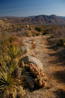
- While they’re walking, they will encounter creatures ranging from cacti to grizzly bears
- They will be carrying everything on their back as they encounter altitudes ranging from sea level to the highest mountain in the lower 48 states
- Check out the PCT map available on our “Dare to Discover” page
California
- 1692 miles of the trail (about 2/3) is in California
- Temperatures can range from the 100’s to below freezing within days of hiking
- The landscape changes dramatically from icy mountain peaks to dry deserts
- Distances between reliable water sources can range from 8 to 20 miles
- Along with battling the weather conditions, Wampus Cat and Zen will face challenges like biting flies, poison oak, and rattlesnakes
- The Sierra Nevada of central California is 800 trail miles long, and includes the longest wilderness, highest mountain, and deepest Canyon in the lower 48 states
- They will then head into the volcanic Cascades of northern CA, which have thick forests full of life
Oregon
- 454 miles of the trail
- Will be the shortest and easiest segment of the trail for Wampus Cat and Zen
- The trail passes through many volcanoes, including Oregon’s largest and most dangerous active volcano, Mt. Hood (11,253′)
- Many lakes, including Crater Lake, the 2nd deepest lake in the U.S., and 7th deepest in the world
- Heavy rains in the northern part of the state produces dense, shady forests
Washington
- This final section through the Northern Cascades is 500 miles long
- Begins on the Columbia River at the Bridge of the Gods (180 feet above sea level), and ends at a monument on the Canadian Border (elev. 4,240′)
- An additional 7 miles were added by the Canadian government beyond the border, ending at Manning Provincial Park
- Wampus Cat and Zen will face many challenges as they climb down into deep canyons and up high mountain passes
- Not only is this section of the trail rugged, but it is also the wettest part of the route, with storms passing through most days of the year
- Highest point on the trail is at Lakeview Ridge (elev. 7,126), just 8 miles before the Canadian border


